Pirin
 Pirin is a typically Alpine mountain (for example, the peaks over 2,600m high are twice more than those in Rila). This mountain’s Thracian name is Orbellus, which means “the snow mountain”. The old Slavic name Peroun, which is closest to its current name, is the name of a high god who lived at the top of Mount Vihren. Pirin is situated in southwestern Bulgaria between the river Mesta in the east and Strouma in the west, and between the Predel Saddle in the north and the Paril Saddle in the south. Pirin stretches from northwestern to southeastern direction.
The total area of the mountain is 2,585 sq km. It’s about 80km long and 40km wide.
Pirin is the second highest mountain in Bulgaria and third highest on the Balkan Peninsula. Its highest peak is Mount Vihren, 2,914m.
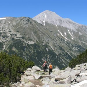
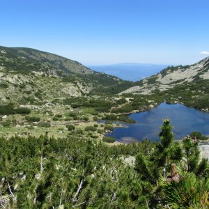
North Pirin is typically Alpine with its steep, insurmountable peaks, rocky crests, beautiful cirque lakes, trough-like valleys, rocky thresholds and moraines. In this part of Pirin one can find its highest peaks starting with Mount Vihren (2,914m), Koutelo I (2,908m), Koutelo II (2,907m) and others. All lakes in Pirin are also in this part of the mountain. There are dozens of ridges with varied relief which separate from the main ridge of North Pirin.

North Pirin is the most visited part of the mountain and mainly the chalets Yavorov, Bunderitsa, Vihren, Bezbog, Demianitsa; and the starting points – the towns of Bansko, Razlog, Dobrinishte and others.
The unique Alpine relief, the virgin parts of Pirin Mountain, the romantic springs and lakes attract a lot of tourists from all over the world.
In order to preserve the unique landscape, the natural formations, the unique Eco-systems and rare plant life and animal species, Pirin was declared a National Park and in 1983 it was approved as a part of the world wildlife heritage and included in the UNESCO‘s List of World Cultural and Wildlife Heritage.


